

| home > national park | ||
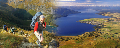
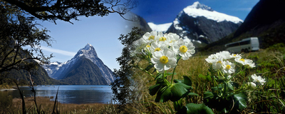
'A cherished corner of the world where mountains and valleys compete with each other for room, where scale is almost beyond comprehension, rainfall is measured in metres and scenery encompasses the broadest width of emotions'.This is how the author of the book "Mountains of Water - The Story of Fiordland National Park" described this stunning National Park. Established in 1952, Fiordland National Park is now over 1.2 million hectares in size, and encompasses mountain, lake, fiord and rainforest environments. The National Park is administered by the Department of Conservation. The variety of habitats in Fiordland support a diverse range of flora and fauna, with many developing in relative isolation leading to a high rate of endemism, or plants and animals that have evolved to be completely unique to this area. Human activity within Fiordland has been limited. Early Maori hunted here, caught fish from the sea and gathered pounamu (New Zealand jade) from the rivers. Much later, European sealers and whalers took shelter in the fiords and built small settlements in some locations, but overall the sheer steepness of the terrain, the incredible isolation, and the wettest climate in New Zealand deterred all but the hardiest from settlement in the region. Fiordland became the scene of one of New Zealand's most significant conservation debates when in the 1960's it was proposed to raise the level of Lake Manapouri to assist hydro-electricity production at West Arm. The ensuing battle resulted in government ultimately bowing to the weight of petitions and passing a bill in the 1970's that gave the lake statutory protection. For more detailed information about the Fiordland National Park visit the Department of Conservation's website http://www.doc.govt.nz |
||